Проверка
Проверка
Проверка
Проверка
Проверка
Проверка
Unlocking Precision with Pixhawk Rangefinders: The Ultimate Guide for Drone Enthusiasts In the world of drone technology, precision is everything. Whether you’re mapping terrains, inspecting infrastructure, or capturing cinematic footage, the ability to maintain accurate altitude and distance is crucial. Enter the Pixhawk rangefinder—a game-changing tool that elevates the capabilities of your drone. But what exactly makes this device so indispensable? Let’s dive into the details and explore how a Pixhawk rangefinder can transform your aerial operations.
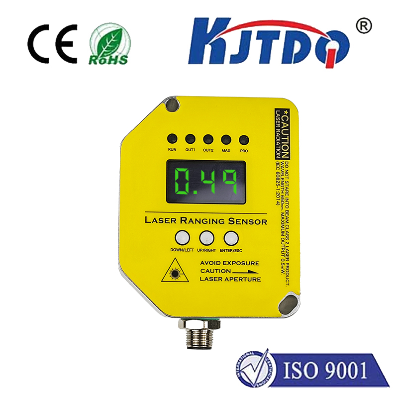
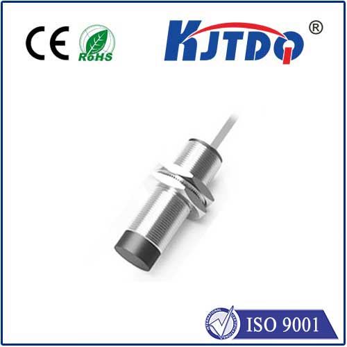
А.Pixhawk rangefinder is a specialized sensor designed to measure the distance between your drone and the ground or other objects. It integrates seamlessly with Pixhawk flight controllers, which are widely used in both hobbyist and professional drones. This device is particularly valuable in scenarios where GPS data alone isn’t sufficient, such as in indoor environments or areas with poor satellite coverage. The rangefinder operates by emitting a signal—often laser or ultrasonic—and calculating the time it takes for the signal to bounce back. This data is then processed by the Pixhawk flight controller to adjust the drone’s altitude and position with pinpoint accuracy.
One of the standout features of a Pixhawk rangefinder is its ability to provide real-time altitude data. Unlike barometric sensors, which can be affected by weather conditions, rangefinders deliver consistent and reliable measurements. This is especially useful for tasks like precision landing or maintaining a stable hover over uneven terrain.
Safety is a top priority in drone operations. A rangefinder helps prevent collisions by detecting obstacles in the drone’s path. This is particularly beneficial in environments where the landscape is unpredictable, such as forests or urban areas.
Whether you’re using your drone for agriculture, surveying, or photography, a Pixhawk rangefinder can enhance performance. For instance, in agricultural applications, it ensures consistent spray height for crop treatment, while in surveying, it aids in creating accurate 3D models of the terrain.
Integrating a rangefinder with your Pixhawk flight controller is a straightforward process. Most rangefinders connect via I2C or serial communication, and the setup can be configured through open-source software like Mission Planner or QGroundControl. Here’s a quick overview of the steps:
Mount the Rangefinder: Attach the device to your drone, ensuring it has a clear line of sight to the ground or target area.

Connect to Pixhawk: Use the appropriate cables to link the rangefinder to the flight controller.
Configure Software: Access your ground control station and enable the rangefinder in the sensor settings. Calibrate the device to ensure accurate readings.
Test and Optimize: Conduct a test flight to verify the rangefinder’s performance. Adjust parameters as needed for your specific application.
Not all rangefinders are created equal. When selecting one for your Pixhawk setup, consider the following factors:
Different rangefinders offer varying measurement ranges. For example, a device designed for close-range applications may not perform well in high-altitude scenarios. Ensure the rangefinder you choose aligns with your operational needs.
Accuracy is critical, especially for precision tasks. Look for rangefinders with a low margin of error, typically measured in centimeters.
Some rangefinders perform better in specific environments. For instance, laser rangefinders excel in clear conditions, while ultrasonic rangefinders are more reliable in cluttered or reflective environments.
In agriculture, drones equipped with Pixhawk rangefinders are revolutionizing crop management. By maintaining a consistent altitude, these drones ensure uniform application of fertilizers, pesticides, and water, leading to healthier crops and higher yields.
In search and rescue missions, every second counts. A rangefinder enables drones to navigate complex terrains, such as dense forests or collapsed buildings, with unparalleled precision. This can be the difference between life and death in critical situations.
For filmmakers, achieving smooth and stable footage is essential. A Pixhawk rangefinder helps drones maintain a steady altitude, even when flying over uneven surfaces. This results in professional-grade aerial shots that captivate audiences.
While Pixhawk rangefinders are highly reliable, users may occasionally encounter issues. Here are some common problems and their solutions:
If your rangefinder provides erratic measurements, ensure it’s securely mounted and free from obstructions. Calibration errors can also cause this issue, so double-check your settings.
In environments with reflective surfaces or high noise levels, ultrasonic rangefinders may struggle. Switching to a laser rangefinder can often resolve this problem.
Not all rangefinders are compatible with every Pixhawk model. Before purchasing, verify that the device is supported by your flight controller’s firmware.
As drone technology continues to evolve, so too will the capabilities of Pixhawk rangefinders. Advances in sensor technology, such as the integration of LiDAR and AI-driven obstacle detection, promise to make these devices even more versatile and powerful. For drone enthusiasts and professionals alike, investing in a Pixhawk rangefinder is a step toward achieving greater precision, safety, and efficiency in aerial operations. Whether you’re navigating challenging terrains or capturing breathtaking visuals, this tool is your key to unlocking the full potential of your drone.