Проверка

Проверка

Проверка

Проверка

Проверка

Проверка
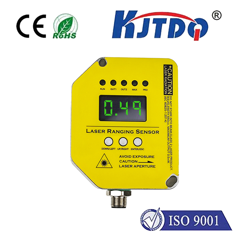
Exploring the Power of LiDAR and RPLiDAR: Revolutionizing Sensing Technology Imagine a world where machines can “see” and map their surroundings with unparalleled precision, enabling everything from autonomous vehicles to advanced robotics. This is no longer science fiction—it’s the reality made possible by LiDAR (Light Detection and Ranging) technology. Among the many LiDAR systems available today, RPLiDAR stands out as a cost-effective, high-performance solution for a wide range of applications. In this article, we’ll dive into the world of LiDAR and RPLiDAR, exploring their capabilities, differences, and the transformative impact they’re having across industries.
LiDAR is a remote sensing technology that uses laser pulses to measure distances and create detailed 3D maps of environments. By emitting laser beams and measuring the time it takes for them to bounce back, LiDAR systems can generate highly accurate spatial data. This technology is widely used in fields such as autonomous driving, robotics, agriculture, and urban planning. One of the key advantages of LiDAR is its ability to operate in various lighting conditions, including complete darkness. This makes it an indispensable tool for applications where precision and reliability are paramount.
RPLiDAR, developed by Slamtec, is a series of compact, affordable LiDAR sensors designed for robotics and mapping applications. Unlike traditional LiDAR systems, which can be bulky and expensive, RPLiDAR offers a lightweight, cost-effective alternative without compromising on performance.
High Resolution and Accuracy: RPLiDAR sensors provide precise distance measurements and high-resolution scanning, making them ideal for detailed mapping and navigation tasks.
Компактный дизайн: With its small form factor, RPLiDAR can be easily integrated into a variety of devices, from small robots to drones.
Affordability: By leveraging advanced manufacturing techniques, RPLiDAR delivers high-quality performance at a fraction of the cost of traditional LiDAR systems.
Многогранный.: RPLiDAR is compatible with multiple platforms and can be used in applications such as SLAM (Simultaneous Localization and Mapping), obstacle detection, and environmental modeling.
The versatility and affordability of RPLiDAR have made it a popular choice across numerous industries. Here are some of the most notable applications:
Autonomous vehicles rely on LiDAR technology to navigate complex environments safely. RPLiDAR’s high accuracy and real-time data processing capabilities make it an excellent choice for obstacle detection, path planning, and localization.
In the field of robotics, RPLiDAR is widely used for SLAM applications, enabling robots to map their surroundings and navigate autonomously. Its compact design and affordability make it particularly suitable for small and medium-sized robots.
Drones equipped with RPLiDAR can perform tasks such as terrain mapping, infrastructure inspection, and crop monitoring. The lightweight nature of RPLiDAR ensures that it doesn’t add significant weight to the drone, preserving its flight efficiency.
In agriculture, RPLiDAR is used for precision farming, enabling farmers to monitor crop health, optimize irrigation, and manage resources more effectively. Its ability to generate detailed 3D maps of fields is invaluable for modern agricultural practices.
RPLiDAR is also used for indoor mapping and navigation, such as in warehouses, museums, and retail spaces. Its high-resolution scanning capabilities allow for the creation of detailed floor plans and obstacle detection systems.
While both LiDAR and RPLiDAR are based on the same fundamental technology, there are some key differences to consider:
Cost: Traditional LiDAR systems can be prohibitively expensive, especially for small-scale projects. RPLiDAR, on the other hand, offers a more affordable solution without sacrificing performance.
Size and Weight: RPLiDAR’s compact design makes it easier to integrate into smaller devices, whereas traditional LiDAR systems are often bulkier and heavier.
Применение: While traditional LiDAR is commonly used in high-end applications like autonomous vehicles and large-scale mapping, RPLiDAR is more suited for robotics, drones, and other compact systems.
As technology continues to evolve, the capabilities of LiDAR and RPLiDAR are expected to expand even further. Advances in artificial intelligence (AI), machine learning, and sensor miniaturization will likely drive new innovations in this field. For example, the integration of AI algorithms with LiDAR data could enable more sophisticated object recognition and decision-making capabilities. Moreover, the growing demand for autonomous systems and smart infrastructure is expected to fuel the adoption of LiDAR and RPLiDAR across industries. As these technologies become more accessible, they will play an increasingly important role in shaping the future of automation and spatial awareness. In conclusion, LiDAR and RPLiDAR represent the cutting edge of sensing technology, offering unmatched precision and versatility. Whether you’re developing autonomous vehicles, designing advanced robots, or exploring new applications, these technologies provide the tools you need to succeed. By understanding their capabilities and potential, you can unlock new possibilities and stay ahead in the rapidly evolving world of technology.
